CAPTURE EXISTING CONDITIONS
3D Laser Scanning in West Palm Beach, FL
Need dependable 3D laser scanning in West Palm Beach? We document accessible building surfaces with mobile reality-capture technology, creating measured information for renovation teams, designers and building owners.
THE SERVICE
What a building scan tells your team
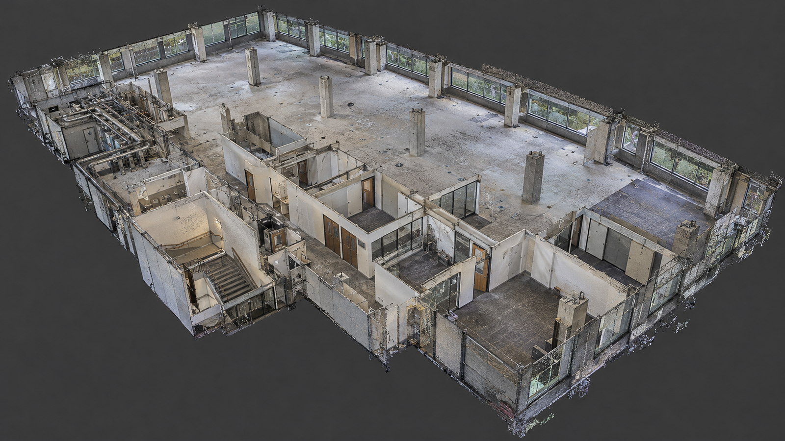
Before floor plans can be trusted, someone needs to verify the building. Our scanning process records visible architecture and spatial relationships digitally, including openings, structural elements, stairs and other accessible features.
A registered point cloud is the measurable reference created by a scanning assignment. Your architect may use the point cloud directly or ask us to convert the captured geometry into floor plans, CAD drawings or a Revit model.
Equipment captures what its sensors can see. Closed rooms, concealed systems, reflective materials and inaccessible locations require practical allowances in the scan plan; we identify those limits instead of inventing missing geometry.
PROJECT OUTPUTS
Files and outputs to agree on
Depending on your brief, project handoff can include registered point-cloud files, site imagery where available, an agreed coordinate system, and optional 2D or 3D derivatives. Let us know the software your team uses before we scope the deliverables.
Details that help us quote accurately
- The floors, rooms and outdoor areas to include
- Whether you need point-cloud data, 2D drawings or a BIM model
- Any tolerance, coordinate-control or file-version requirement
- Access hours, occupied areas, security procedures or site constraints
COMMON USES
Where this service is useful
Renovations: establish the location of existing walls and openings before layout decisions.
Commercial interiors: capture conditions in occupied offices, shops and fit-out spaces.
Complex architecture: collect spatial information in areas difficult to measure by hand.
Building records: create a useful visual and geometric reference for future upgrades.
HOW PROJECTS WORK
A practical four-step project process
01. Set your objective
Tell us what decision the information must support and which spaces are involved.
02. Review what exists
We discuss plans, source files, property access and any unknowns.
03. Confirm the handoff
Specify software, model or drawing scope, schedule and exclusions.
04. Check your files
Compare the delivered information with the agreed output list and request clarification where needed.
LOCAL SERVICE
3D Laser Scanning in West Palm Beach — project scope
From downtown commercial premises to residential renovations and older structures, West Palm Beach projects benefit from a clearly defined capture boundary. Describe the property, available access and intended design work so we can identify an appropriate field plan.
FREQUENTLY ASKED QUESTIONS
3D Laser Scanning in West Palm Beach — practical questions
How accurate is a 3D laser scan?
We use advanced German NavVis laser scanning technology capable of millimeter-level accuracy to capture your property in precise detail. This creates a reliable foundation for as-built drawings, CAD plans, and BIM models, helping your team plan confidently and reduce costly measurement errors. We confirm the accuracy requirements for your project before scanning, so the results support your intended use.
How can laser scanning help before a property renovation?
Measured scan information can give designers a clearer reference for existing walls, openings and room relationships. It supports planning, but it does not eliminate the need to verify critical conditions.
What should be ready before the scanning appointment?
Confirm which spaces are included, arrange property access and tell us about restricted areas, active operations or safety requirements. The scan plan can then be matched to the site and project goals.
Can the captured building data be useful for later phases?
Often, yes. A retained point cloud can provide a measured reference for future drawing or modeling work, depending on the data available and the project requirements. We can discuss suitable file formats at handoff.
TECHNICAL READING
Technical resources for your design team
Your consultant may want technical guidance for file handling and software compatibility. These independent references are informational and do not imply affiliation.
Discuss the right scope before work begins
Tell us the building type, your starting materials and the format your team must receive. We will discuss options and next steps before confirming the project scope.